 PROLONGED WINTER WEATHER EVENT TONIGHT THROUGH SATURDAY… .A series of Pacific storms will bring a mix of freezing rain, sleet and snow to portions of northwest Oregon and southwest Washington through the weekend. The next storm will arrive tonight and bring a high potential for significant freezing rain accumulations in the Coast Range, Willapa Hills, the Central Willamette Valley and perhaps across the southern Portland metro.
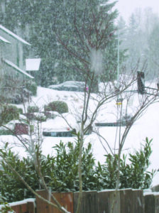
There is also high potential of significant snowfall for inland areas from the Cowlitz River Valley to the Portland/Vancouver metro area, and areas to the east through the Columbia River Gorge and Hood River Valley. …WINTER STORM WARNING REMAINS IN EFFECT UNTIL 4 PM PST SATURDAY… * WHAT…Mixed precipitation expected.
This will fall mainly as snow for the north and east Portland/Vancouver metro areas. Freezing rain, sleet and some snow will persist to the west and south of downtown Portland. Total snow accumulations of 1 to 3 inches appear most likely across the far south and west Portland metro. Total snow accumulations of 4 to 12 inches appear most likely across the north and east metro.
No Comments
Leave a comment Cancel